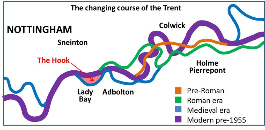
The Trent established its current flood plain at the end of the last ice age. Meandering continued within this plain, as illustrated from the graphic (from Salisbury et al. Mercian Geologist, vol9,no4, p189-207, 1984) The Hook seems to have become defined as a cut- off meander from medieval times. Human settlement of the Trent Valley occurred from the Bronze Age onwards, with the primal forest progressively cleared for cultivation. Roman era log boats were found during the excavations of the National Watersports Centre in 1967. Evidence of Norman and medieval fish weirs and later weirs and structures to aid early navigations have also been excavated.
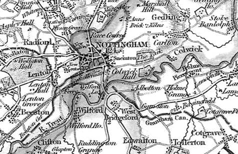
Walkers 1836 map gives an appreciation of pre-industrial Nottingham and surroundings, showing the Nottingham and Grantham canals and the early Midland Railway line, terminating in the City. (taken from nottshistory.org.uk, courtesy A.P Nicholson) The meanders of the River Trent are close to those of the present day and the village names along its banks are all recognisable. Holme Lane leads from Trent Bridge to the hamlet of Adbolton, passing by the area of The Hook.
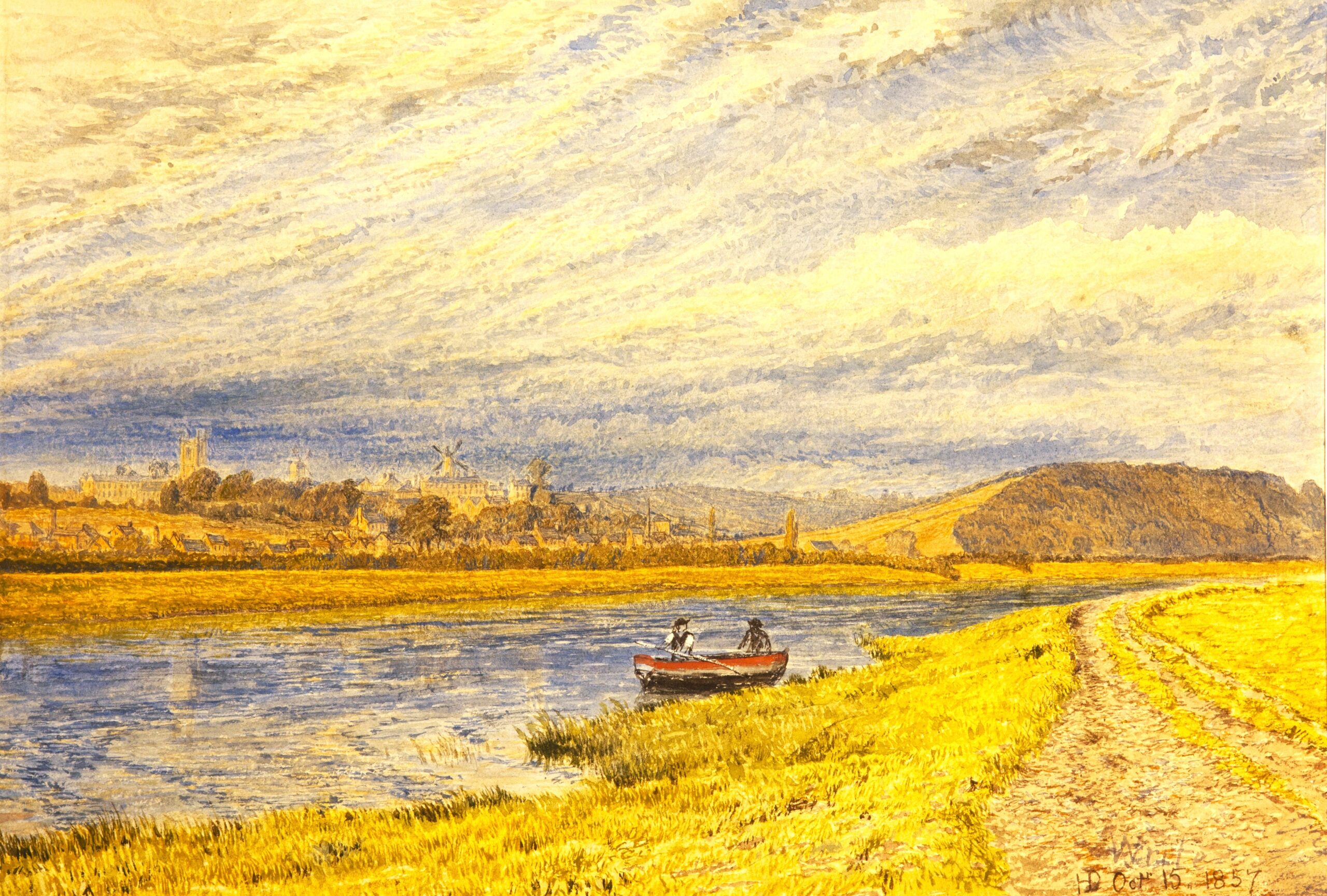
This 1865 painting by Henry Dawson shows Colwick Hill, viewed from the south bank of the Trent just upstream from The Hook (courtesy of Nottingham Museums and Galleries). Sneinton Church and Green’s mill can be seen on the opposite bank, also houses of the growing residential areas. The towing path is a reminder of the importance of the Trent for commerce, but otherwise the land along the river is still rural. The meadows appear to slope gently down to the water with no obvious flood banking.
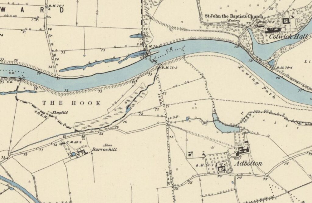
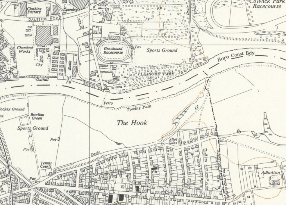
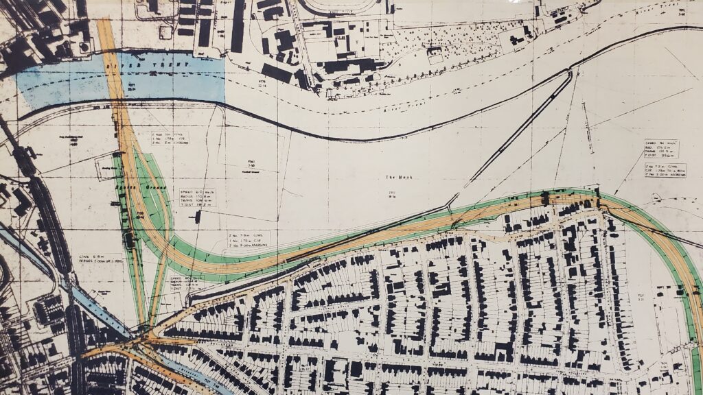
This Ordnance Survey map of 1885 shows The Hook as a defined area on the south side of the Trent. Nottingham City is to the west and Colwick hall is further along the river to the east. Holme Lane can be seen (now Holme Road) with Burrowhill Farm on the highest point of the rise. The Hook was used for cattle and sheep grazing and no doubt flooded regularly. The ditch and marshy area would have been an old river course and possibly the shape of the land gave The Hook its name. Interestingly The Hook was within the City jurisdiction until various land swaps between City and County in 1952.
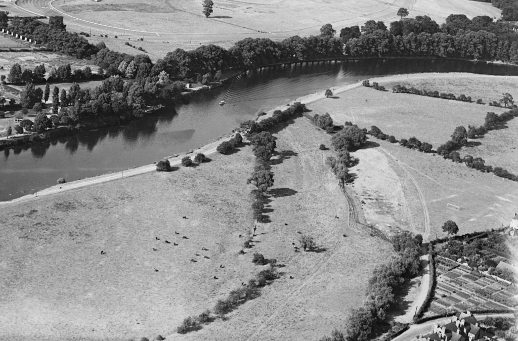
This 1934 aerial photograph shows The Hook still as an area of water meadow, with evidence of cattle grazing in the large field. However goal posts to the right of the image reveal other recreational uses and people can also be seen walking on the various footpaths. The Mona Road allotments are also seen at the bottom right of the image, although the neatness suggests that at this time the site was a market garden. The old meandering drainage ditch is still apparent, following a line of trees close to Holme Road. (photo courtesy Britain from Above)
This OS map (ca1952) shows the landscape just prior to the commencement of the major flood prevention works along this stretch of the Trent. The old river meander is still apparent, which defines The Hook area, although now the City Boundary is along the centre of the river. The Lady Bay residential area is fully developed and there is a foot ferry to take people across the river to the pleasure park and greyhound track on the north bank of the Trent. The Boots Co sports ground is to the left. Trent Basin was developed in the 1930s and now seems to have a railway spur plus neighbouring chemical works. More information on the history of the Trent Depot can be found from a study commissioned by the developers of the new residential areas on the site.
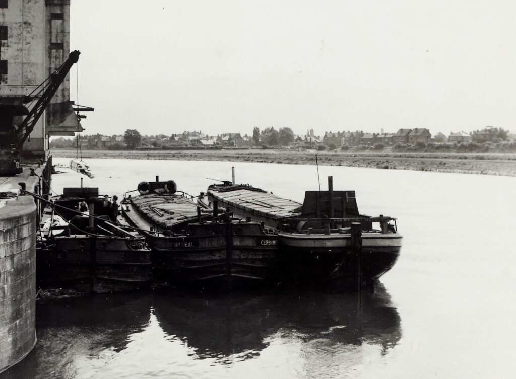
This ca1960 photo looking across towards The Hook was taken from the entrance to Trent Basin. The south bank of the river has clearly been scraped back following the 1950s flood prevention works. Comparing modern and old maps, around 1-2 metres of bank was removed. Spoils from the dredging and excavations were spread over The Hook site, flattening out the existing features, including the remnants of the old river loop. The new drainage dyke was probably cut at this time. (photo courtesy Canals and River Trust)
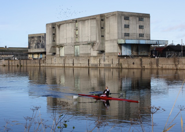
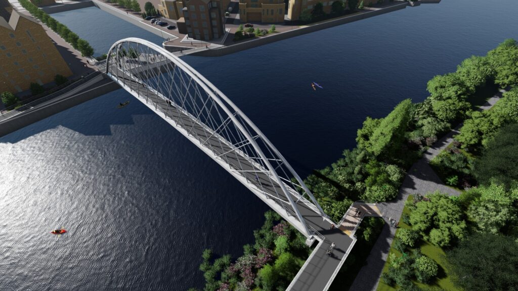
The concrete structures of the No.1 and No.2 Trent Depot warehouses were a prominent sight opposite The Hook, until their eventual demolition in 2012 (photo courtesy A Rowe). The site has now been developed as a riverside residential district, with the proposal for a new pedestrian footbridge linking the basin entrance to the south riverside path. At the time of writing (Dec2023) the groundworks for the bridge were under investigation.
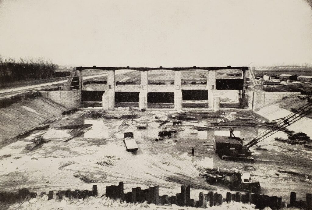
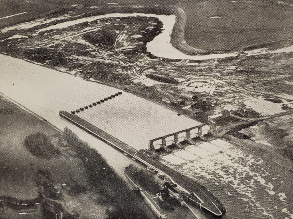
After the disastrous floods of 1947 the pre-war plans for flood alleviation through Nottingham were quickly developed and implemented. Construction work took place between 1952-55, including building of the new Holme Cut and Sluices and also major remodeling of The Victoria Embankment. The river was also widened between Holme and Lady Bay Bridge. Images courtesy of Nottinghamshire Archives)
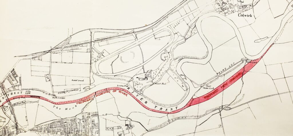
This 1947 sketch shows early proposals for a new river channel and river widening up to Lady Bay bridge, including the banks of The Hook. Later designs moved the new channel and sluices to the line of the exiting cut. The old lock is still in existence – now used for hydro-electricity generation. Ultimately around 1-2 metres were shaved from the south bank along The Hook, with reshaping of the north and south bends downstream to improve flow.
What might of been! In the brave new world of the 1950s and 1960’s proposals were put forward for an eastern Trent road crossing. Nottingham archives holds plans of various options that were postulated at an early stage in the design process. This suggested route runs along the edge of The Hook directly adjacent to Holme Road and clips the last houses at the corner of Adbolton Grove. It didnt happen! The conversion of the Lady Bay rail bridge for road traffic has hopefully taken away the necessity of anything quite as drastic!
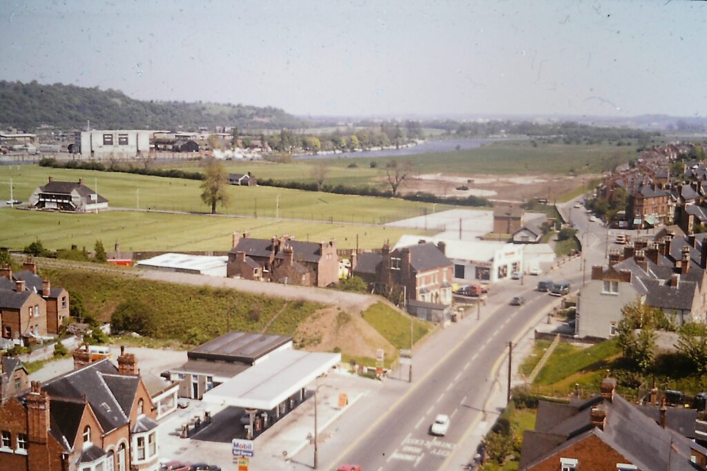
This photo taken from the top of Trent House in 1974 gives a clear view of The Hook and the adjacent Boots sports ground. The Melton Mowbray rail line has been abandoned but the embankments are still in place, showing where the bridge crossed over Radcliffe Road. The Grantham canal has been infilled at this point and a roundabout junction can be seen at the entrance to Holme Road. Drew’s garage is the white building near this junction. There is evidence of ground works at the south west corner of The Hook, which presumably would be for the construction of the carpark and the first incarnation of the play area. The rest of The Hook is still mostly devoid of trees, the space was used for travelling fairs and gymkhanas.
The Hook area was within the spill zone of the 1950s flood prevention works and did become inundated on rare occasions, most notably in 1974. This photo was taken at the brick flood wall at the end of Holme Grove, looking out over the the allotments which existed at that time along Holme Grove path. The Trent Depot warehouses on the right showing the actual river course.
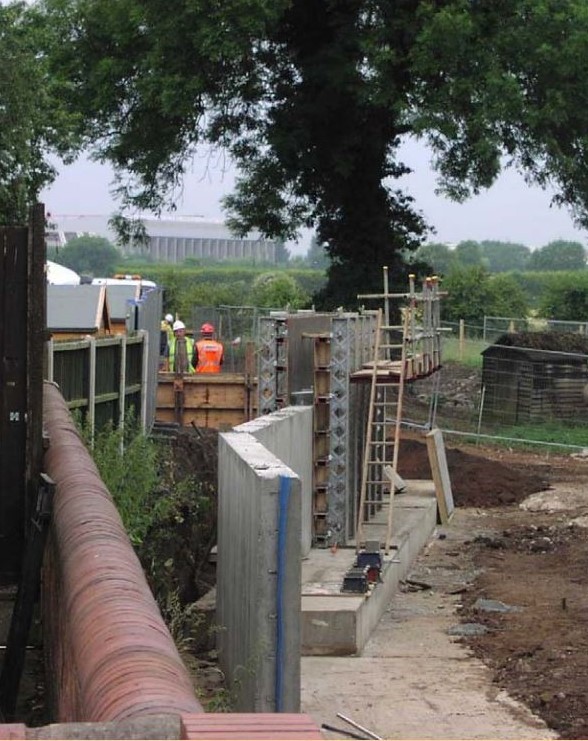
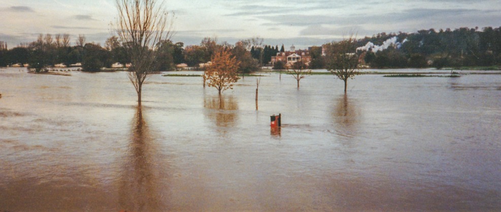
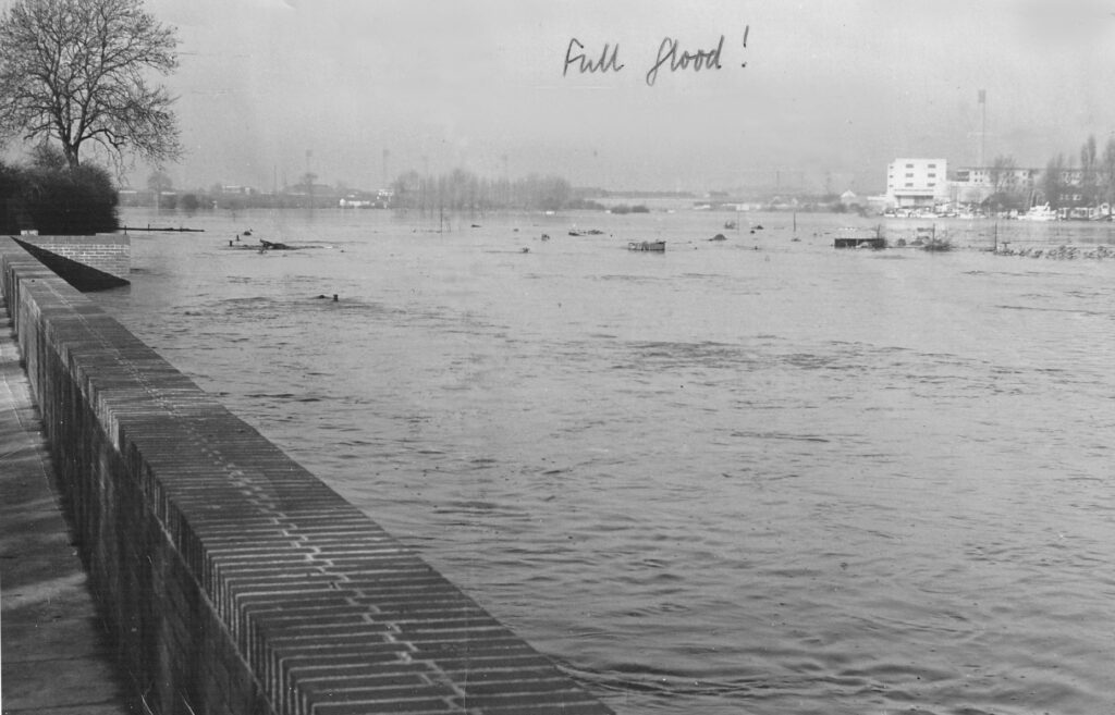
A major flood occurred again in April 2000, which almost overtopped defenses in the city. The Hook was inundated again, here viewed also from the end of Holme Grove. The dog bin on Holme Grove path indicates the depth of water. After this event plans were put in place for further enhancement of defenses, now taking into account the likely effects of global warming. The photo shows major concrete barriers being errected along the south boundary of The Hook, with remodeling of gardens along Holme Road. The City football ground can be seen in the distance.
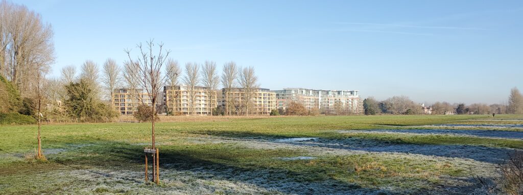
The row of poplars at each end of the riverside path were planted in the late 1970s and are now a prominent feature of The Hook. Developments continued through the 1980s and 1990s, with upgrading of the river path, addition of benches and further planting of trees throughout the site. The new Queens Jubilee Woodland was planted by Rushcliffe Borough Council in 2022 to mark this royal occasion. Around this time plantings also took place along the riverside path and Melbourne Road path. The view of the north bank has changed dramatically since 2008, first with the construction of Riverside Crescent and later the Trent Basin and Yacht Park residential developments. Although these edifices may not entirely complement natural features of The Hook, they are now an accepted part of the landscape. The Hook gained the status of a Local Nature Reserve at the end of 2009, securing its future as a vital green space.